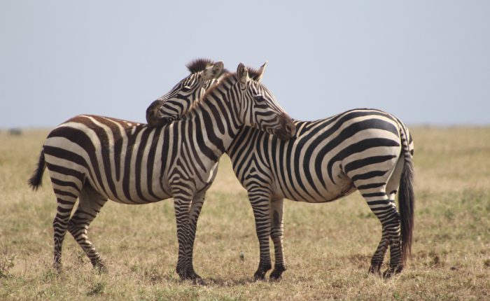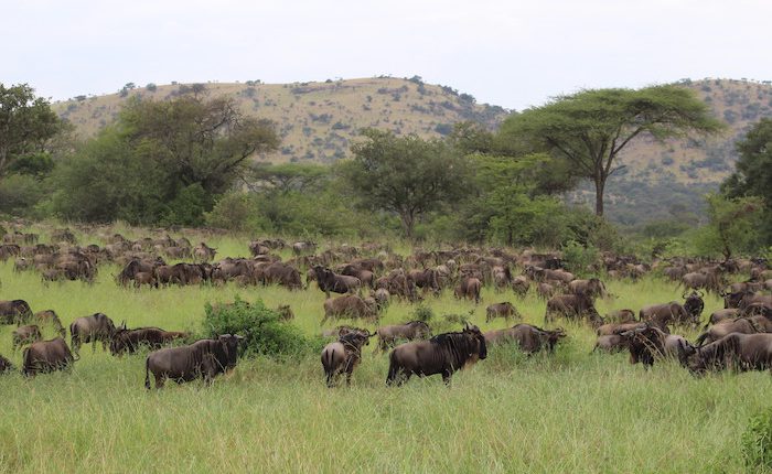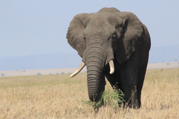
Tanzania, officially known as the “Republic of Tanzania” is an East African country located just south of the Equator. Explore the nature and beauty of Tanzania from savannah national parks, forests, mountains, beaches, etc. The Tanzanian safari in the Serengeti National Park, Mt Kilimanjaro, Ngorongoro crater, and several other fascinating nature and wildlife areas are some of the top reasons people visit Tanzania. Birding Tanzania is a highlight for both hard-core birders and those leisurely involved in bird-watching safaris.
The country became a sovereign state in 1964 after the union of the previously separate states of Tanganyika and Zanzibar. Mainland Tanganyika accounts for more than 99 percent of the combined territories’ total area. The rest are the Mafia Island which is administered from the mainland, whereas Zanzibar and Pemba are administered separately. Dodoma has been Tanzania’s designated official capital since 1974 and it is centrally located on the mainland. Its largest city and port is Dar-es-salaam.
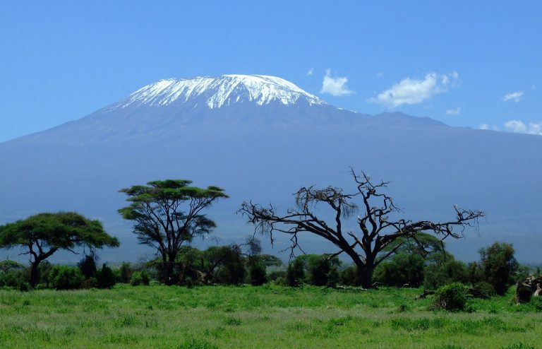
Tanzania is 947,303 square kilometers (365,756 square miles) making it the 13th largest country in Africa and the 31st largest in the world. It shares borders with Kenya and Uganda to the north, Rwanda, Burundi, and the Democratic Republic of the Congo to the west, and Zambia, Malawi, and Mozambique to the south. Tanzania is located on Africa’s eastern coast, with a 1,424-kilometer Indian Ocean coastline. It also includes several offshore islands, including Unguja (Zanzibar), Pemba, and Mafia. The country is home to Africa’s highest and lowest points: Mount Kilimanjaro at 5,895 meters (19,341 feet) above sea level and the floor of Lake Tanganyika at 1,471 meters (4,826 feet) below sea level.
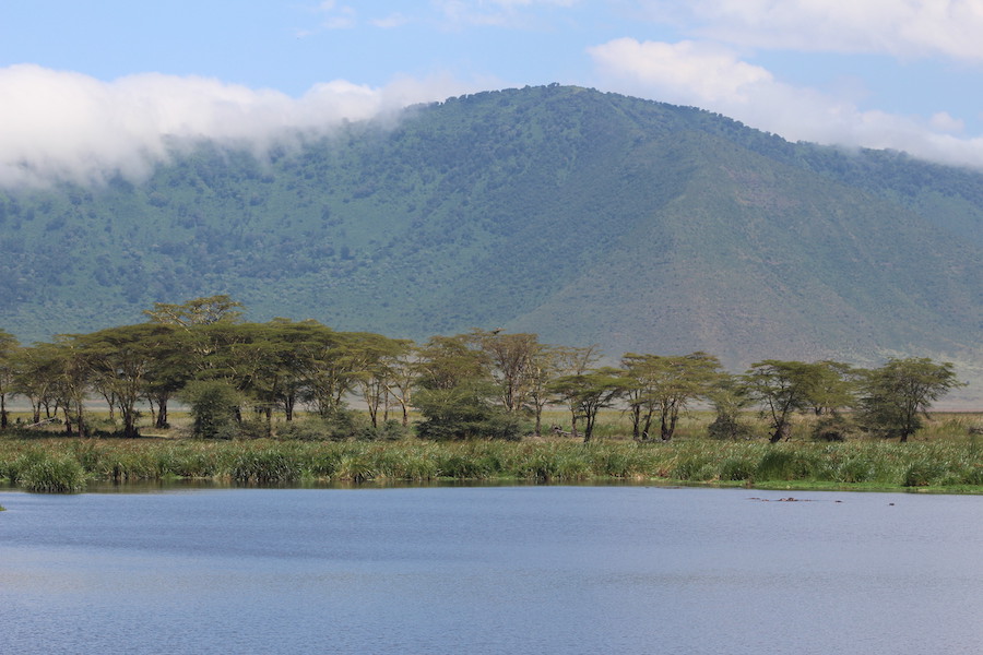
Tanzania’s northeastern region, which includes Mount Kilimanjaro, is mountainous and densely forested. The country also contains a portion of three of Africa’s Great Lakes. These include Lake Victoria which is Africa’s largest lake, and Lake Tanganyika, the continent’s deepest lake, which is located to the north and west, respectively. The lakes are known for their unique fish species. Lake Nyasa which is found to the southwest. The central of Tanzania is the large central plateau with plains and arable land.
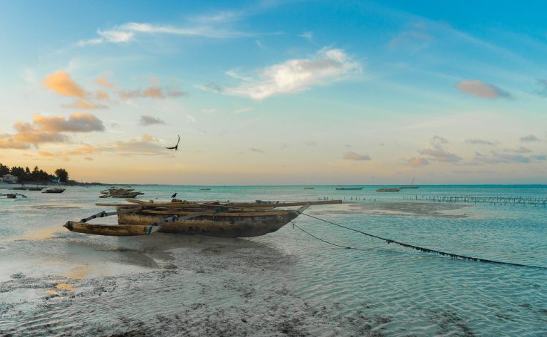
The Zanzibar Archipelago is just offshore on the eastern shore, which is hot and humid. Kalambo Falls, located near the south-eastern shore of Lake Tanganyika on the border with Zambia, is Africa’s second-highest uninterrupted waterfall. Menai Bay Conservation Area in Zanzibar is the largest marine protected area.
Mainland Tanzania is divided into four major climatic and topographic zones: the hot and humid coastal lowlands of the Indian Ocean shoreline, the hot and arid zone of the extensive central plateau, the high inland mountain and lake region of the northern border, where Mount Kilimanjaro is located. Furthermore, the highlands of the northeast and southwest, with climates ranging from tropical to temperate. Elevation changes influence Tanzania’s warm equatorial climate. The high amount of solar radiation throughout the year is associated with a limited seasonal variation in temperature: the mean monthly variation at most stations is less than 9 °F (5 °C). Ground frosts are uncommon below 8,200 feet (2,500 meters).
Rainfall in Tanzania is highly seasonal. Approximately half of mainland Tanzania receives less than 750 mm of precipitation per year, which is considered the minimum required for most tropic crop cultivation. The central plateau receives less than 510 mm of rain per year on average and has only one rainy season between December and May. Rainfall is heavier along the coast, with two precipitation peaks: October-November and April-May.
Tanzania’s population, according to most credible surveys, includes more than 120 different indigenous African peoples, the majority of whom are now grouped into larger groups. Some of the smallest ethnic groups are slowly disappearing. This is a result of the effects of rural-to-urban migration, modernization, and politicization.
Today, the majority of Tanzanians are of Bantu origin, with the Sukuma, who live in the country’s north, south of Lake Victoria, constituting the largest group. Other Bantu groups include the Nyamwezi, who live in the west-central region; the Hehe and Haya, who live in the country’s southern highlands and northwest corner, respectively. The Chaga of Kilimanjaro live on the mountain’s southern slopes whereas the Makonde, live in the Mtwara and Ruvuma regions of the southeast. The Maasai, Arusha, Samburu, and Baraguyu are Nilotic peoples who live in the north-central region of mainland Tanzania. Another ethnic group of significant size and influence is the Zaramo, a highly diluted and urbanized group. The majority of the Zaramo live in Dar es Salaam and the surrounding coastline. The Zanaki is the smallest ethnic group and lives near Musoma in the Lake Victoria region. Julius Nyerere, the country’s founding father and first president (1962 – 1985) belonged to the Musoma ethnic group.
Tanzania is safe for tourists. Tourism provides a large part of the country’s foreign income and the local authorities take matters of security very seriously. Moreover, Tanzania is one of the most politically stable countries in the region and Tanzanians are very friendly as a people.
This said, some criminality does exist, just as it does everywhere else. We, therefore, recommend that you exercise common sense and follow the rules below: